
The PO.DAAC is pleased to announce the public release of the NASA-SSH Sea Surface Height from Standardized Reference Missions Only Version 1 datasets produced by NASA. Two distinct datasets are released. The datasets are produced from observations of sea surface height from the radar altimeter satellites in the reference mission orbits, including TOPEX/Poseidon, the Jason series, and Sentinel-6. All missions have been referenced to a common baseline, additional quality control has been performed, and errors with wavelengths around one orbital cycle have been reduced. More information regarding NASA-SSH is available from PO.DAAC’s NASA-SSH mission page.
-
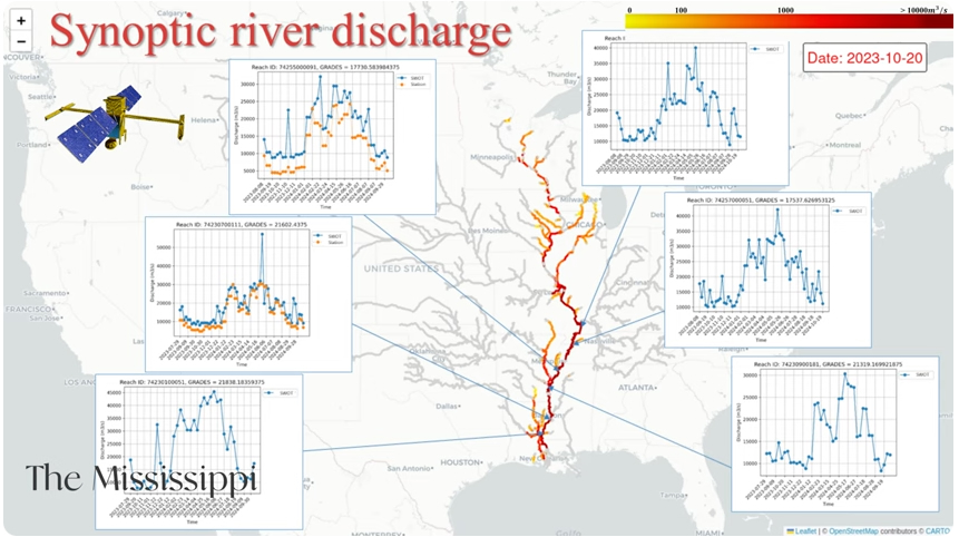
Dataset Highlight: River Discharge from the SWOT Mission
Dr. Hind Oubanas, CNES’s Surface Water and Ocean Topography (SWOT) Hydrology Science Lead, gives an overview of SWOT river discharge data products and algorithm development. Specifically, the Dr. Oubanas describes the work of the SWOT Discharge Algorithms Working Group (DAWG), detailing how river discharge is derived from SWOT observations, and what products are being developed and validated.
-
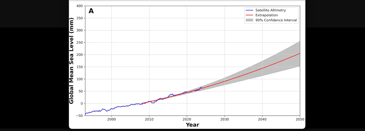
Data in Action: The rate of global sea level rise doubled during the past three decades
Global Mean Sea Level time series from 1993 to 2023 from altimetry. Past and current altimetry measurements allow us to monitor global sea level and to make projections for the future. If the current trajectory continues, global sea levels will increase by more than 16.9 cm over the next three decades.
-
Data in Action: Deep Learning Improves Global Satellite Observations of Ocean Eddy Dynamics
Mesoscale eddies, circular currents of water with diameters spanning from 50 to 300 kilometers, transport freshwater, heat, carbon, nutrients, etc. around the world and within the ocean, profoundly impacting marine ecosystems and the Earth's climate.

-
Worldview Tour Story: El Nino Impacts Around the Globe
Learn about recent El Nino events through Sea Surface Temperature (SST) anomalies in the Pacific Ocean

-
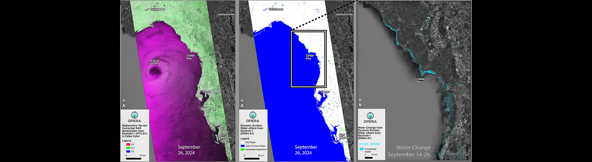
Data in Action: OPERA: Mapping Flood Waters in the Face of the Storm
On September 26, 2024, Hurricane Helene made landfall in the Big Bend area of the Florida Gulf Coast as a CAT 4 storm, causing coastal flooding from 15 feet of storm surge.
-
New PO.DAAC animation now available!
COWVR Level 2 Wind Speed - First Year of Operation